


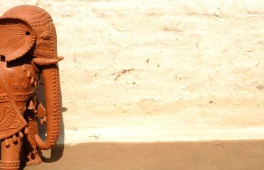
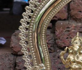
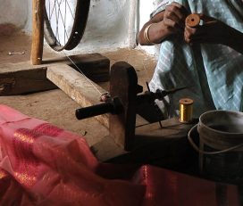
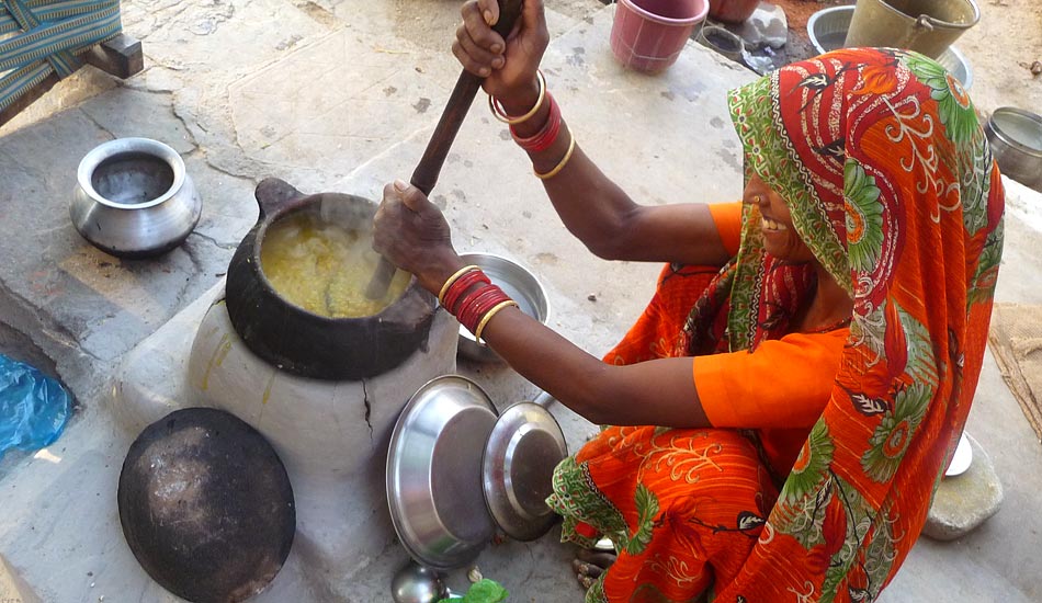
Bell Metal ~ Kunhima...
Bell Metal Kunhimangalam, an ancient lost-wax casting tradition creating Panchaloha idols, temple lamps, ritual objects, bells, and utensils.
Kunhimangalam, Kerala, India...
Wood carving is one of the ancient methods of expression. Idols for worship, decorating architectural elements, ritual objects like masks or totem poles, toys etc. were skillfully crafted using wood. Being a material once abundantly available, it found various forms and usages, transformed in the hands of the craftsmen.
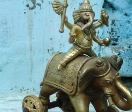
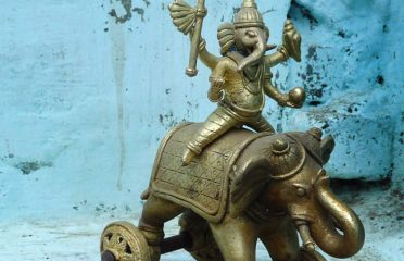
Bell Metal Kunhimangalam, an ancient lost-wax casting tradition creating Panchaloha idols, temple lamps, ritual objects, bells, and utensils.
Kunhimangalam, Kerala, India...
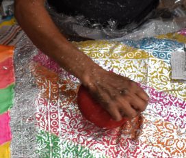
Chaapa relies on a combination of adhesive and extremely thin metallic foil to create decorative motifs on fabric.
Magadh, Gaya, Bihar, India...
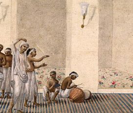
Among the many schools of painting that emerged during the transition from Mughal sovereignty to British colonial rule, Patna Kalam occupies a distinctive position within the history of South Asian art.
Patna, Bihar, India...
Let us talk… if you feel the same love for handmade, and would like to support us by sharing your research or by contributing financially to our documentation efforts.
Reach us at [email protected]

These masks are a craft technique to the tribes of Bandhavgarh, where these would be made as religious iconographies on trees or masks used worship or kept in a shrine. Today, with a hard lifestyle in the forests, many of these tribal people have come to Khajuraho, knowing the tourist inflow to make a living.
The wood-carved Gods and masks are used for decorative purposes. Woodwork is also put to use for making chillums, hookahs etc., which are still used in the villages. Figures of gods and goddesses are also made for worship.
The significance of these masks lies in ancient religion of praying to the older Gods like trees, the Sun and the moon, the sky, water, the wind and other such elements in nature which these tribes have regarded to, as nature’s supreme elements which keep life going. These masks have ancient rituals and beliefs trapped in them from time immemorial and bring out the raw pure hearts of people living out of civilization.
The members of the Kul Bhil tribe use these for worshipping. These are called Kagda. During the Ashad pooja or prayers to the monsoons, the tribals sing and dance adorned with these masks. With the coming of iconographic Gods after the Gods of nature, they also believe that Kali and Durga, the goddess resides in the forests. Therefore the worship is conducted in the forests, praying to protect the people from wild animals and evil spirits.
In India, the tradition of woodcarving existed from the ancient times. Mostly, only the stone-carved sculptures have survived, but these speak clearly of their wooden ancestors on which they were based on. Ancient wood carved temples, which have survived in the hill areas of Himachal and Uttar Pradesh, are similar in style to the Gupta period temples. The craft of woodcarving is mentioned in the Rigveda.
The Matsya purana talks of how every home should have a doorframe carved out of wood as a sign of welcome to the visitors. Carved wooden frames and later balconies with detailed brackets became a tradition in homes and palaces. Each region developed it’s own style and design in wood carving, depending on the local traditions and materials available. These developed mostly due to worship. For example, Assam had places of worship called Namghars, which were constructed out of wood. In south India, there were large Rathams or chariots for taking out the deities or idols in a procession during certain festivals.
The tribal population crafted gods and goddesses out of wood. They even made masks and totem poles out of wood. Very few of these are to be found due to their easy deterioration caused by termites and rain. These were important features in festivities and worships. These were also used for amateur theatrical performances. It was believed that the Bhil tribes made shrines with wood, and this is when the craft originated.
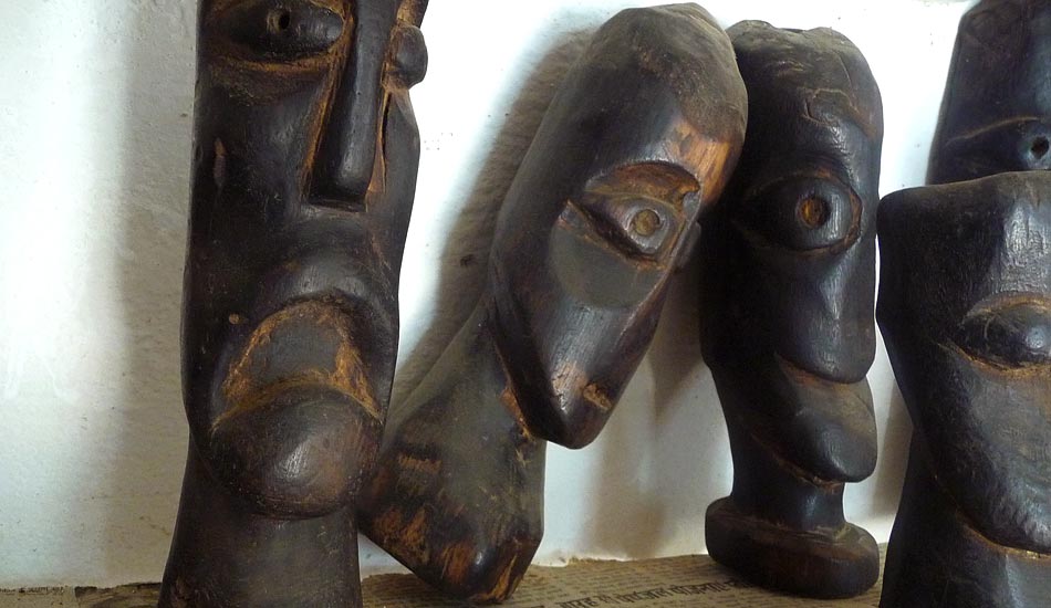
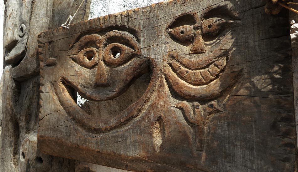
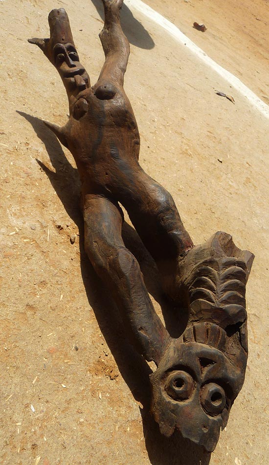
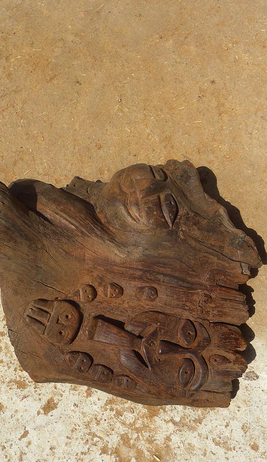
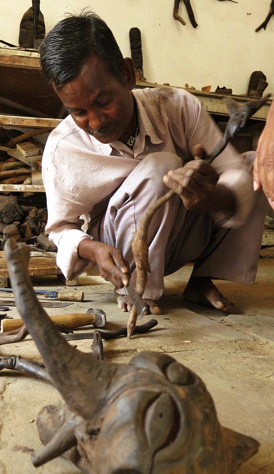
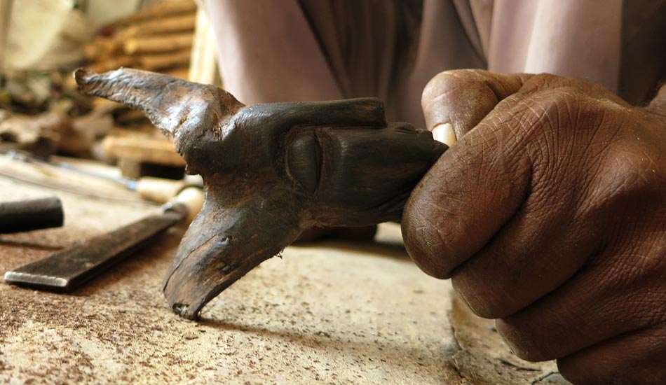
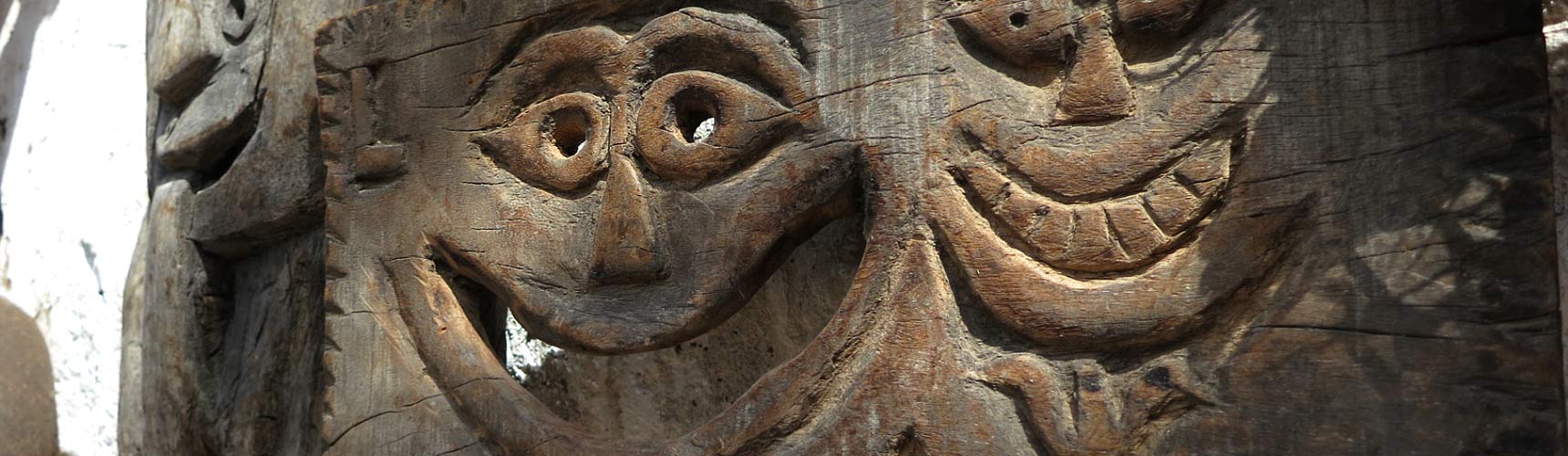
Large faces are chiseled out on pieces of wood. The surfaces are not smooth but have some crudity. Nevertheless there is detailing. The value is based on the kind of wood used.
The nose and the lips are made to be large. The eyes are rounded with a dot-like depression in the middle in case it represents an animal, and streamlined fish-shaped eyes in case it is a god. There are strong resemblances to African tribal art.
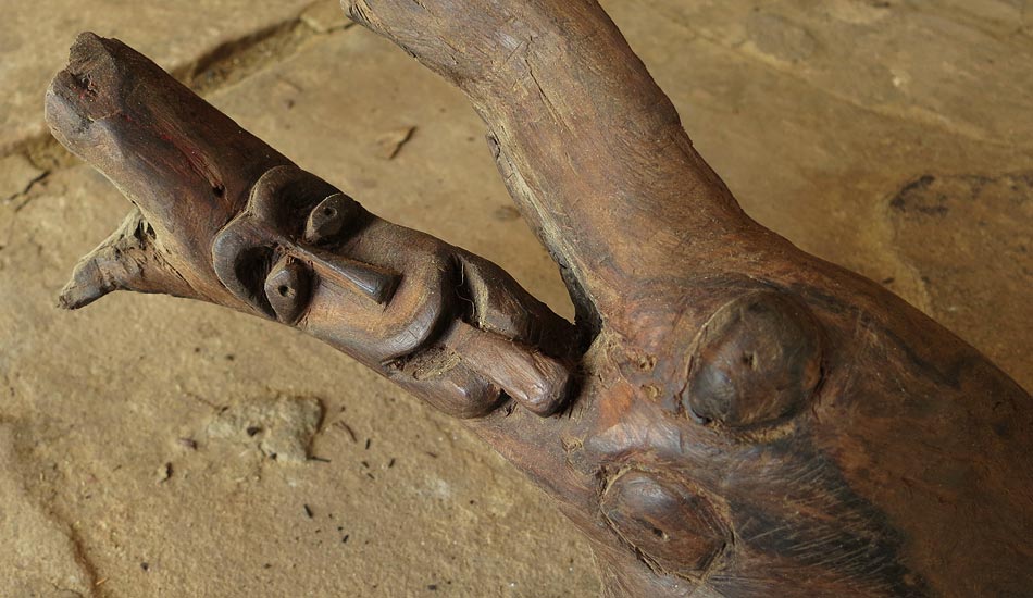
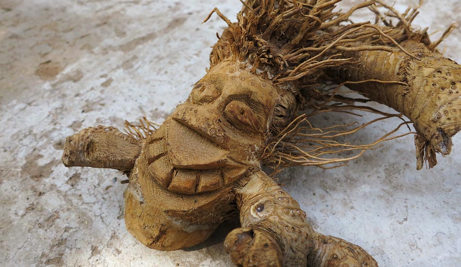
The beauty of these masks lies in the usage of the already present form of the wooden block. The formations of crevices and twigs, branches and cracks are all accounted as design elements, carving around them to bring out a clear form.
The amount of design precision that is shown here lies not in the smoothness and finish of the masks but in the orientation of the elements and their keen eye of using them and how this vision has been passed down through generations.


These masks and sculptures are not crafted anymore. The need and usage has died down.
Only the old works are remaining. Very few craftsmen sculpt these out to sell it to the tourists. These masks are now antique pieces and neither have a cluster nor the original artisans.
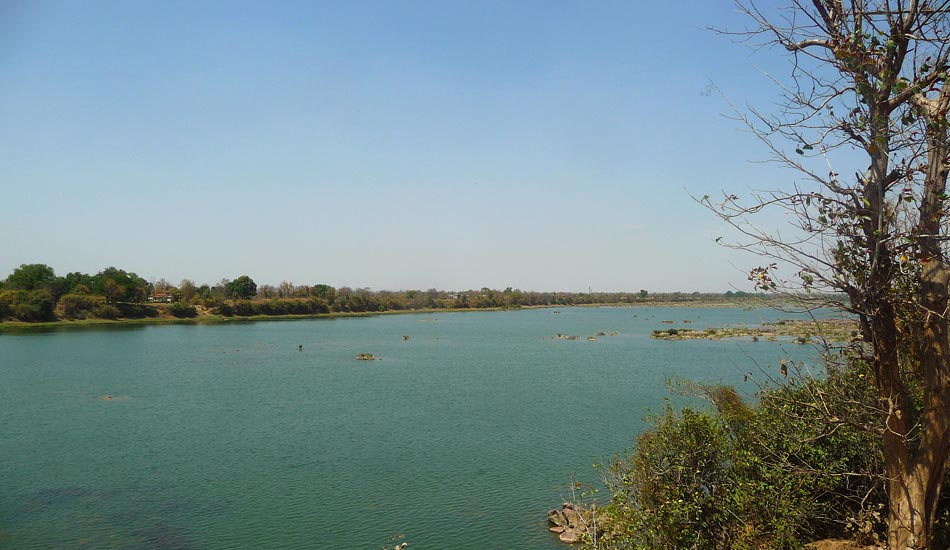
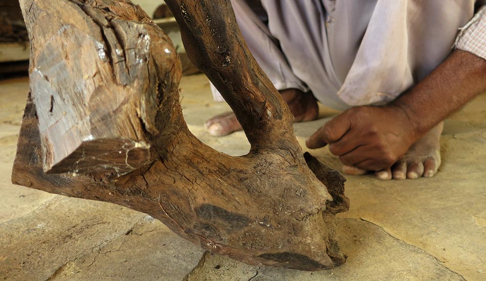
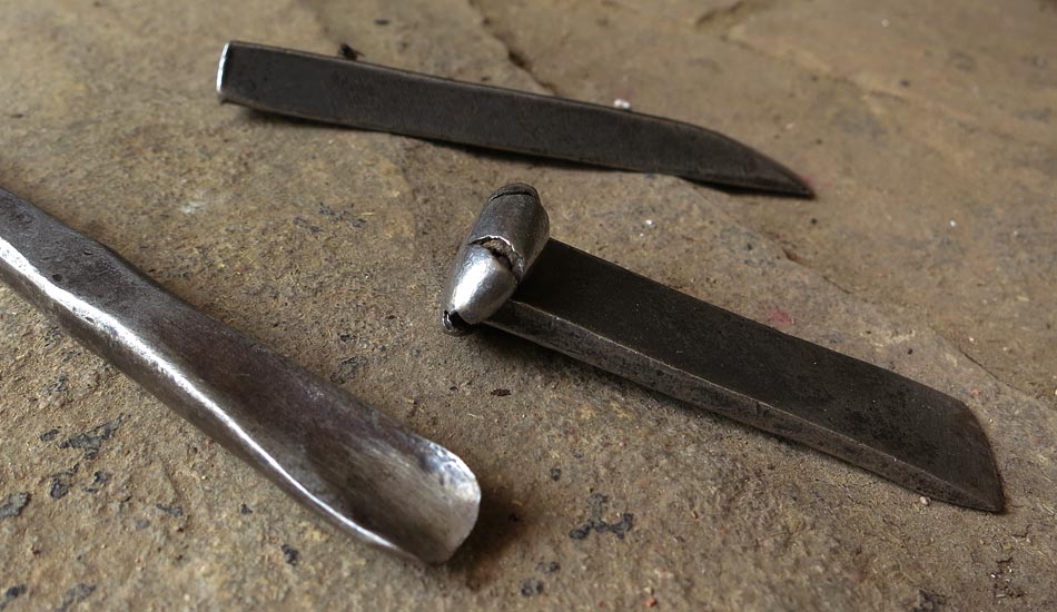
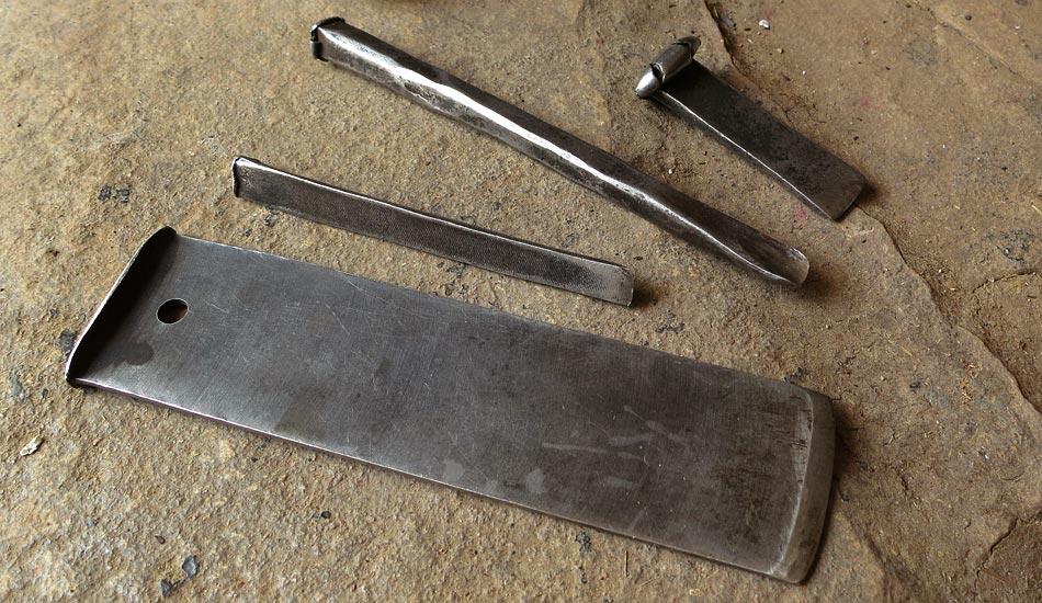
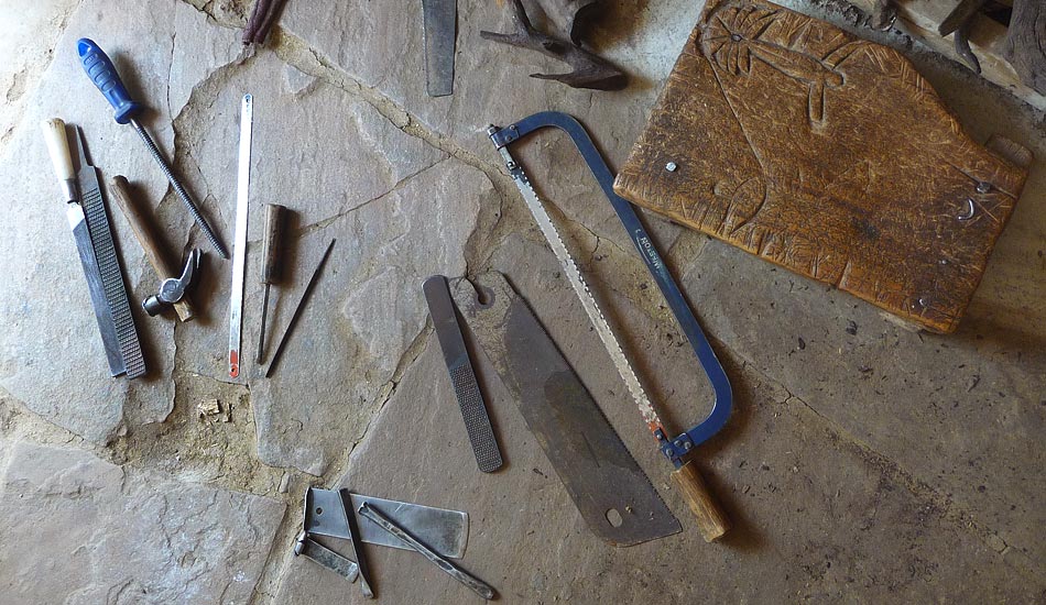
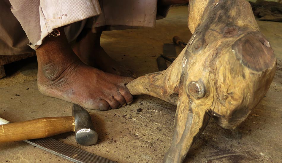
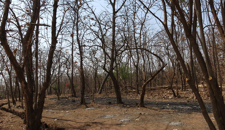
Wood found in water or thick roots were taken from the banks of the river. These were then chiseled with various indigenous or custom-made tools to craft elaborate masks or other carvings on wooden elements.
Kava – Roots of old trees are taken from the banks of the river Ken.Pieces of wood floating in water
Sarson ka tel or Mustard oil-

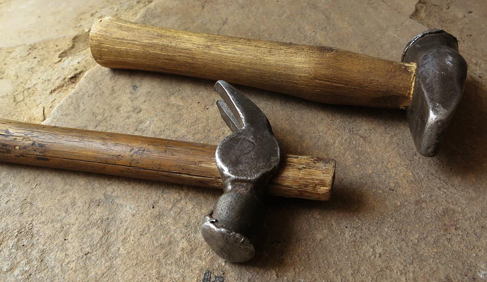
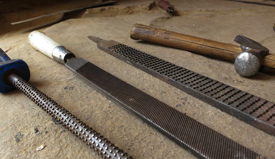
These masks were made at a time when these artisans would forge their own tools and hence the tools would be of the rawest form. Aari (Saw), Basula or Axe, Hathodi or Hammer, Gheni or chisels, Rethi or File
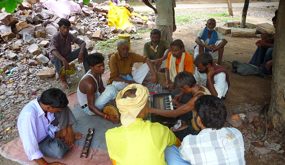
Not much is known about the rituals revolving around these masks. But, knowing that these masks were mostly carved as faces of Gods, we know that there would be a number of religious and auspicious ceremonies surrounding it, if not festivals as well.
Wood found in water or thick roots were taken from the banks of the river. These were then chiseled with various indigenous or custom-made tools to craft elaborate masks or other carvings on wooden elements.
Once the monsoons would be over, and the river’s filling water receded, the trees on the banks would be left broken with their roots sticking out of the soggy banks. The tribal people would collect these roots, to use the wood for carving masks.
If the wood obtained needed to be skinned and cleaned, it was done first. The wood was then dried till the sap, after which, the craftsmen directly would set about to work on it. The wider chisels were used to clean and mark the designs. The finer ones were used to chisel out details. After the features were carved in, the final finishing was done using the files or sand paper. Mustard oil was rubbed over the finished product as a final polish and to protect it from insects and decay. Depending on the design, the process took from one day to 5-7 days.


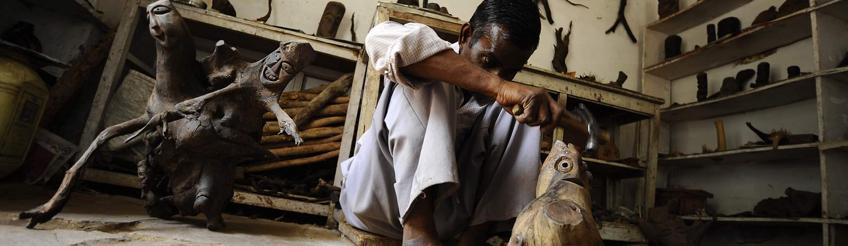
The waste that was left was just sawdust from the finishing of the masks and small pieces of wood from the carving. These being biodegradable wastes never harmed the forests and could be used up over time as manure when the rains would come.
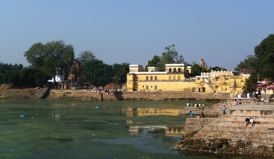
The earliest reference, of the larger area in which Khajuraho is also a part of, is from the Indian epics, the Ramayana and Mahabharatha, where some of the places near Khajuraho are mentioned. The region comes under the flood plains of river Yamuna, and was bounded by the Vindhya Mountains in its southern side, resulting in developing a separate and unique culture from the rest of south India. The historic significance of the region starts from the reign of Gupta rulers (4-5 AD) when the site falls in between the ‘Gupta route’ connecting Kaushambi and Ujjain.
The physical manifestation of Khajuraho, comprising of the old settlement and Rajnagar with all its complexity began to develop from the Chattarpur time. Pratap Singh (1816-1854), the Raja of Chattarpur did some renovation works in the temples and once again there developed human in-habitation around the western group of temples.
Rajnagar, the ‘administrative capital’ of Khajuraho is not far from the temple complex. The fort and the structures that we see now date to the Chhatarpur period. The royal status of this settlement is evident by the presence of many royal gardens (unfortunately, many of the gardens are now ‘lost’ or in a very bad state of preservation). Here the old settlements developed in a spine between hill and lake and was concentrated around Jalsena and Thaneralakes. At a later stage, with the Fort becoming a feudal symbol the settlements became more concentrated around it.
The settlement has five major routes connecting to Mahoba,Chattarpur, Ganj, Khajuraho and Pachhon.Unlike the rural settings of the old village settlement, Rajnagar with its population of the trading class was semi-urban in nature
The last settlement to develop in the region is the ‘New Khajuraho’, a modern settlement that developed in 1970s on both sides of the Jain road. With the temple complex declared a ’Special Area’ and later a World heritage Site, tourists poured in great numbers. These developments had its impact in the region.
In 1952 the monuments in Khajuraho were declared as of national importance followed by its taking over by the A.S.I in 1953. This was a turning point in the development of the region. With the new status tourists started pouring in great numbers to the area. Khajuraho also had an airport right from 1960s, quiet near to the temple complex. In 1973 Khajuraho came under the S.A.D.A (Special Area Development Authority) and its boundary was notified in 1975.
Khajuraho is located at 24.85 deg N 79.93 deg E in the Chhatarpur district of Madhya Pradesh. It has an average elevation of 283 metres (928 feet) . The town is bounded by the Dantla and Lavanya hills in the east and south east.The northern side also is bounded by a series of hills. The river Ken delineates the boundary in the east and the river Dhasan in the west. The location of Khajuraho is in the central part of the Vindhya hill ranges.The hill range of Vindhyas, the oldest rock series in India, forms a natural demarcation line between the north and the south India
By Air
Khajuraho is connected to Delhi & Agra with regular flights.
By Road
Khajuraho is connected by regular bus services with Mahoba, Harpalpur, Satna, Jhansi, Gwalior, Agra, Jabalpur & Bhopal.
By Rail
Khajuraho has its own rail head. Apart from that, the other nearest railheads are Mahoba (64 km) and Harpalpur (94 km). Jhansi (175 km) and Satna (117 km) are convenient railheads for visitors from Delhi, Mumbai, Calcutta, Chennai, Agra & Varanasi.
The year may divided into four seasons. The cold season. December to February is followed by hot season from March to middle of June. The normal maximum temperature received during the month of May is 42.30 degree C & minimum during the month of January is 7.10 degree C. The period from middle of June to September in the south west monsoon season. The normal annual rainfall of Chhatarpur is 1068.3 mm. It receives maximum rainfall during south west monsoon period i.e. June to September. October and November from the post monsoon or transition period.
The district as a whole lies in the Yamuna sub basin of the Ganga basin and traversed by the left bank tributaries of the Ken & the right bank tributaries of the Dhasen. Paddy, Jowar, Maize, Tuar, Urad, Til groundnut Soyabean, Sugarcane (Kharif) and wheat, Gram, Alsi, Muster, Rai & Vegetable (Rabi) are the main crops. Pyrophite Dysphor, Okar and Chhui Mitti are the minerals found in the District.
The soils in the district are generally of classified into four groups:
- Alluvial soils of north eastern part of the district.
- Red and yellow soil of north eastern parts
- Mixed red & black yellow soil of central part
- Medium black soil in the south western extreme of the district.
In 1986 the Kandariya temple was declared as a World Heritage Monument and the Western group of temples as a World Heritage Site. After this the town mushroomed with shops, hotels, restaurants, guest houses and curio shops. The density was more around the temple precincts.
New settlements also developed around the temple. The railway station was added in 2010 to manage the tourist influx. A new urban settlement evolved in contrast to the traditional settlements. The new settlement had migrants from neighboring villages coming in for potential work in the world heritage site.
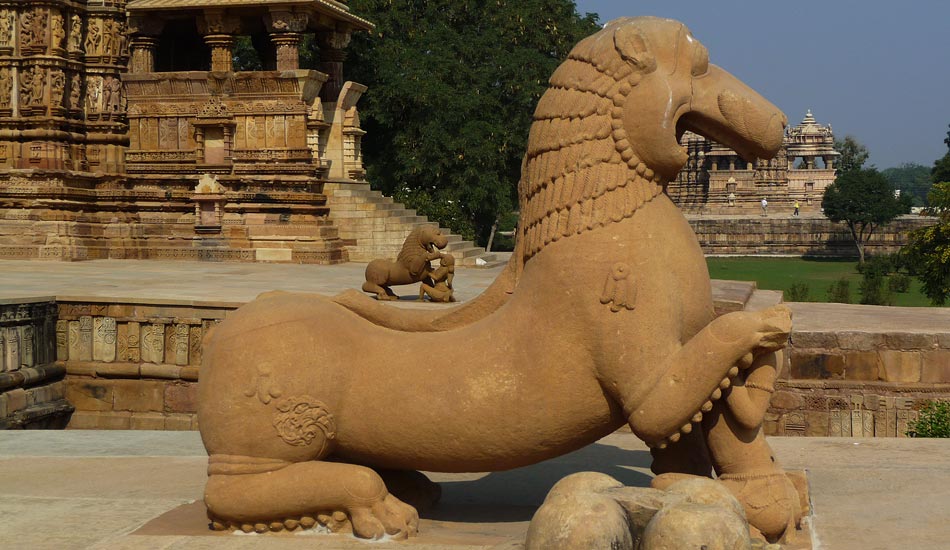
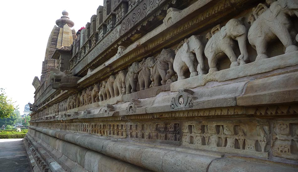
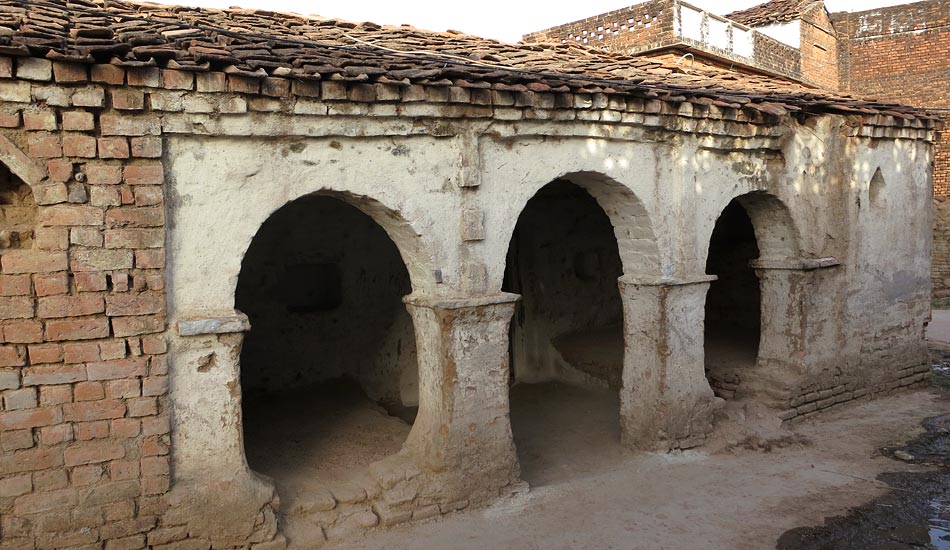
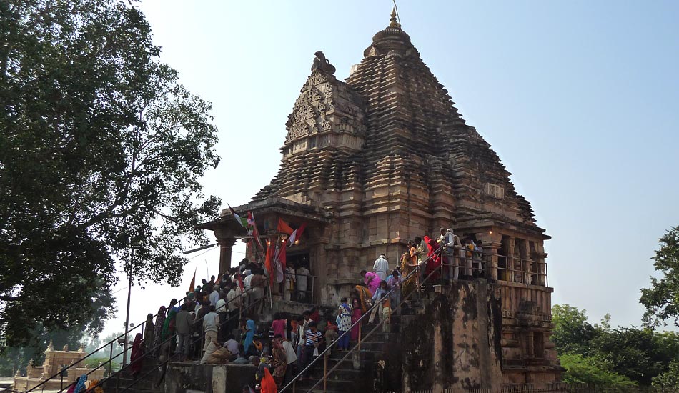
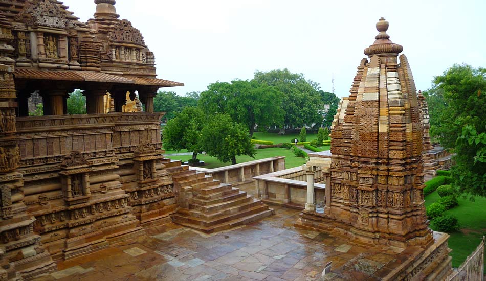
Khajuraho is famous for it’s temple complex. The temples have exquisite craftsmanship and lofty proportions. Many of the temples have fallen with the passage of time. The only reminders are the scattered debris that are found throughout the landscape of Khajuraho.
The buildings were built in a unique style of architecture, using sandstone and precise joints of mortise and tenon. These stand together with the help of gravity alone. The buildings do not use mortar, which makes them different from other architectural styles. It is spread over a whopping 20 sq km.
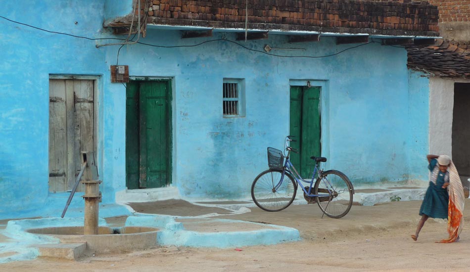
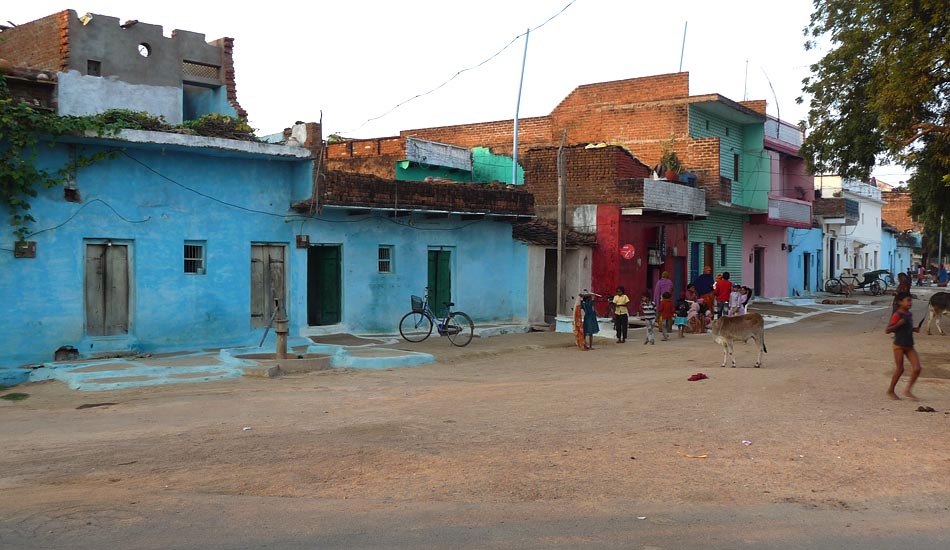
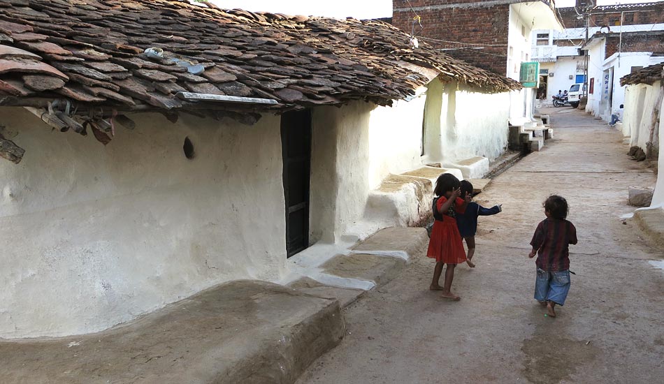
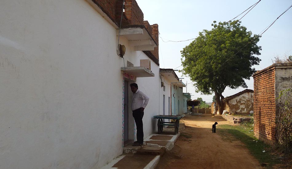
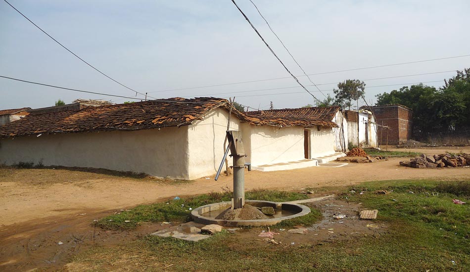
The residential parts consist of Sevagram, Santhi Nagar and Patel Nagar. These have all developed linearly along the spine connecting the western and eastern group of temples. On both sides of the main spine, the Jain Road developed the commercial part comprising of the various craft shops, hotels and guest houses for the tourists. Even inside the new settlement there are traces of the old Puri Kshetra. where there are chabutras acting as open spaces within a cluster of old mud houses. The majority of the settlement has new concrete ‘pucca’ houses which are a stark contrast to the environmentally sustainable vernacular houses of the traditional settlements
Khajuraho was known to be an important centre for the arts, nurturing music, dance, poetry, painting, astrology and astronomy. The people in the surrounding villages and settlements lead simple lives, making their livelihood out of handicrafts, souvenirs and agriculture. Hindi is spoken with the local Bundelkandi dialect. English is also spoken by quite a few people.
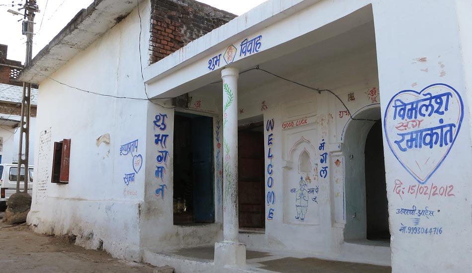
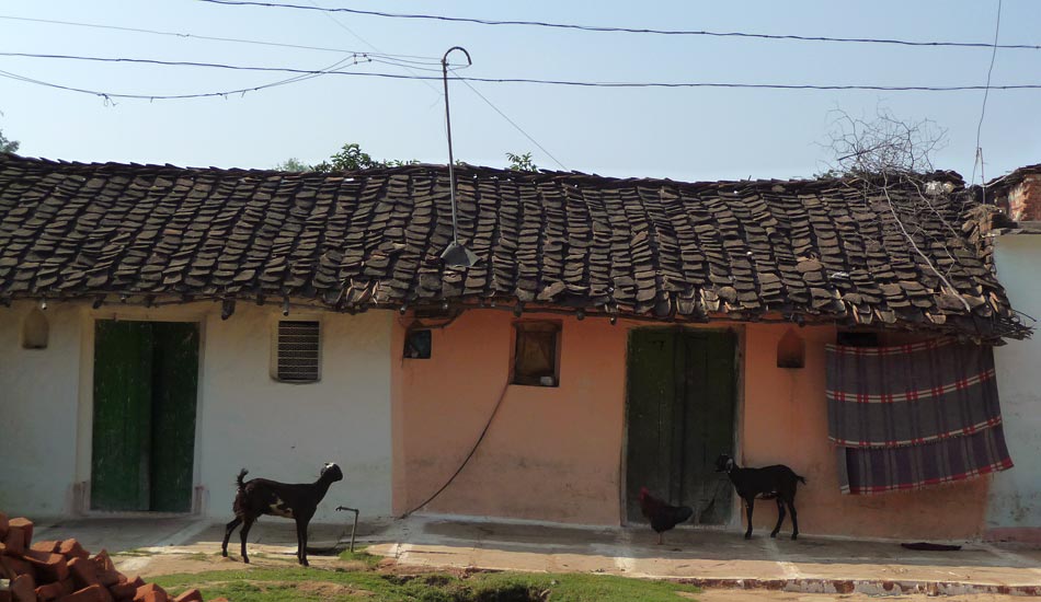
Khajuraho belong to a small and modest village of about 3000 denizens living. They follow the Hindu and Jain religions. The majority also belong to the tribal population. They live in the village and work on their farms and small businesses. According to a resident, the aspiration of most young men is to become a tour guide.

Khajuraho festival
The world renowned temple town of Khajuraho in Madhya Pradesh designated by UNESCO as a world heritage site for its archaeological and historical monuments. During the months of Feb-March, it draws crowds from India and abroad to a culturally enriched festival of classical dances. The exponents of popular classical dance forms are invited from every part of the country to perform during this week long festival.
Rajgarh Palace
25 km from Khajuraho, just 50-year old Rajgarh Palace is situated at the foot of Maniyagarh hills. Ajaygarh Fort: 80 km from Khajuraho, Ajaygarh Fort is situated at a height of 688m. This fort remained the capital of Chandelas during the dark times before their reign ended. Kalinjar Fort 100 km from Khajuraho, Kalinjar fort is as old as the Gupta period and was won over the Chandela ruler Shri Yashovarman in the 10th century. This fort is situated on the Vindhya ranges.
Ken Gharial Sanctuary
24 km from Khajuraho, Ken Gharial sanctuary is the best place to see the crocodiles with long-snouts living in their natural home. The dreadful glimpse of the sharp teeth seemingly ready to engulf you at once does not correspond to the behavioral characteristics of these crocodiles with normally peaceful nature. However, it is best to keep the distance.

List of craftsmen.
Team Gaatha
Indian Folk Arts and Crafts Jasleen Dhamija National Book Trust, India Published in 1970
The Tribal Art of Middle India A personal record by Verrier Elwin Oxford University Press, First published in 1951
